Image
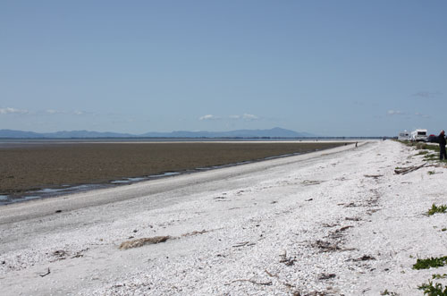
This distinctive stretch of beach consists of ridges of gravel, shell and sand atop a muddy base, the result of a tidal movement that has shifted the upper layers south along the shoreline. This view shows the Taramaire Wildlife Refuge for sea and shore birds, near Miranda.
Te whakamahi i tēnei tūemi
Te Ara - The Encyclopedia of New Zealand
by Janine Faulknor
This item has been provided for private study purposes (such as school projects, family and local history research) and any published reproduction (print or electronic) may infringe copyright law. It is the responsibility of the user of any material to obtain clearance from the copyright holder.