Image
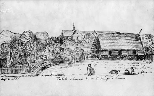
The missionary Richard Taylor, who served at Pūtiki from 1843 to 1866, made this pencil and ink drawing in 1858 of the mission church at the settlement and the house of its most prominent chief, Mete Kīngi Te Rangi Paetahi. It shows fenced gardens, and elements of both European and Māori architecture in Mete Kīngi’s house.
Te whakamahi i tēnei tūemi
Alexander Turnbull Library, Whanganui Historical Society
Reference: NON-ATL-0130
by Richard Taylor
Permission of the Alexander Turnbull Library, National Library of New Zealand, Te Puna Mātauranga o Aotearoa, must be obtained before any re-use of this image.