Land reserves such as national parks have been accepted in New Zealand for well over 100 years. But it was not until the 1970s that people began to realise the importance of reserving some parts of the sea – areas from which no harvest is allowed.
Marine reserves
After many years of lobbying by scientists and divers, New Zealand’s first marine reserve was created in 1975. Formerly known as the Leigh Marine Reserve because of its proximity to the township of Leigh, its official title is the Cape Rodney–Okakari Point Marine Reserve. Today the area is a drawcard for Aucklanders, who live just 90 kilometres to the south, and around 250,000 people visit each year.
Such was the opposition to marine reserves, mainly from recreational fishermen, that only two were created between 1975 and 1990. Some commercial fishermen favour marine reserves, as they are aware that stocks have declined.
We want to make a reservation
New Zealand’s legislation for marine reserves is unique – any incorporated society can propose a marine reserve. Conservation groups such as the Royal Forest and Bird Protection Society have proposed several. In Fiordland the Federation of Commercial Fishermen nominated the northern half of Milford Sound as a marine reserve, and this was approved in 1993.
From 1990 momentum developed and reserves increased significantly. By the 2000s environmental groups and some marine scientists were lobbying for a target of 10% of New Zealand’s Exclusive Economic Zone to be held as reserves. A survey in early 2005 found that 90% of New Zealanders wanted more marine protection.
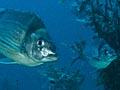
In 2015 New Zealand had 44 marine reserves covering 9.5% of its coastal waters (within 12 nautical miles of the coast). These are ‘no take’ areas, administered by the Department of Conservation. No living things can be removed, except for approved scientific purposes. People are free to swim, snorkel, dive and boat in the area.
Marine parks
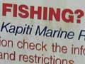
There are two marine parks: Mimiwhangata (on the east coast of Northland) and Hauraki. Tawharanui, once a marine park, became a marine reserve in 2011. Each park has different regulations: Mimiwhangata principally protects reef fish, but not animals such as spiny lobster and green-lipped mussels. Fishing and shellfish gathering is allowed throughout the Hauraki Marine Park, except in the five areas (less thatn 0.3% of the park's total area) set aside as marine reserves.
Marine protected areas
In 2014 there were three marine protected areas: the Sugar Loaf Islands near New Plymouth, the Fiordland (Te Moana o Atawhenua) marine management area and the Kaikōura (Te Tai ō Marokura) marine management area. All three have marine reserves within their boundaries; a variety of fishing regulations apply to the other waters. The Kaikōura area also contains a whale sanctuary, a fur seal sanctuary, two taiapure areas and three mātaitai reserves.
Māori fisheries management
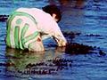
Māori notions of marine conservation are different to the preservationist, no-take approach. In recognition of this, and of Māori customary fishing rights, the Ministry of Fisheries and iwi (tribes) from around the country have worked to create reserves known as mātaitai and taiapure where fishing has traditional significance.
Taiapure are fishing areas intended to be managed by local tribes. They must be important for local Māori, and lie within traditional fishing grounds. Administrative committees recommend regulations to manage the harvest, including commercial fishing. By 2012, eight taiapure had been established.
Mātaitai are areas where local tribes manage all aspects of non-commercial fishing by making by-laws, which apply to everyone. Generally, commercial fishing is not allowed within mātaitai. By 2012, 25 mātaitai had been created, covering 32,200 hectares.
The individuals responsible for managing tribal fisheries are known as tangata kaitiaki (in the North Island or Chatham Islands) or tangata tiaki (in the South Island or Stewart Island). They act as guardians of customary fishing in their area.
Marine mammal sanctuaries
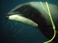
In 1988 New Zealand’s first marine mammal sanctuary was established around Banks Peninsula, as high numbers of Hector’s dolphins were being caught in set nets. This area was extended in 2008. Fishing restrictions and restrictions on seismic surveys are intended to minimise disturbance to marine mammals. A second sanctuary, established in 1993, surrounds the Auckland Islands to a distance of 12 nautical miles offshore. This protects the main breeding areas of the New Zealand sea lion and the southern right whale. It was also made a marine reserve in 2003, to protect the rich marine life. In 2008 four more marine mammal sanctuaries were established. Catlins Coast, Clifford and Cloudy Bay and Te Waewae Bay sanctuaries protect Hector's dolphins. The largest, the West Coast North Island sanctuary, was created as part of a plan to protect Hector's and Māui's dolphins. It stretches from Maunganui Bluff in Northland to Ōakura Beach in Taranaki, and covers around 1,200,086 hectares.