
Kōrero: Volcanoes

Taranaki ring plain

Image
Taranaki ring plain

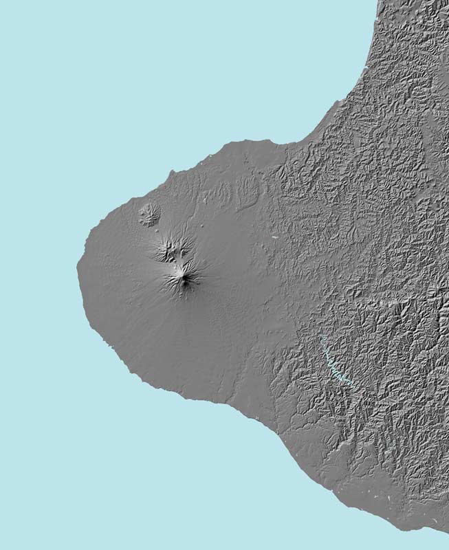
On the Taranaki peninsula, a line of three cone volcanoes (Taranaki, Pouākai, and Kaitake) is surrounded by a huge ring plain of avalanche, lahar, and tephra deposits. The ring plain appears smooth in the digital terrain map and contrasts with the dissected hill country to the east.

Te whakamahi i tēnei tūemi

GNS Science

Permission of GNS Science must be obtained before any use of this image.

Ngā whakaahua me ngā rauemi katoa o tēnei kōrero

Me pēnei te tohu i te whārang

Richard Smith, David J. Lowe rāua ko Ian Wright, Volcanoes – Cone volcanoes and volcanic fields, Te Ara – the Encyclopedia of New Zealand, https://teara.govt.nz/mi/map/8703/taranaki-ring-plain (accessed 4 June 2026).

He kōrero nā Richard Smith, David J. Lowe rāua ko Ian Wright, i tāngia i te 2 March 2009.

Comments

Ross MacNicol
18 August 2011
A characteristic of the Taranaki Volcanic Ring Plain is the radial drainage pattern, with hundreds of streams radiating outwards from Maunga [Mount[] Taranaki much like the spokes of a bycycle wheel. A drive on the high level road between Stratford and Okato will cross many of these streams often on one lane bridges. This pattern of drainage produces nearly parallel streams with relatively small catchments which demonstrate fast rising and falling flood peaks after heavy rainfall.