Kōrero: City planning

Christchurch's plan (3 o 4)

Christchurch's plan

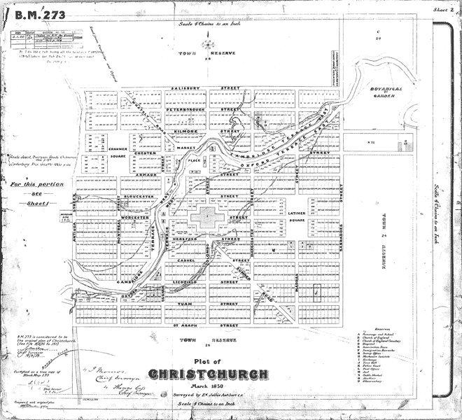
Christchurch’s flat site made it easier to execute its plan. Centred on a central cathedral square, its grid was the most regular of the four settlements, the symmetry broken only by the course of the Avon River and two diagonal streets.

Te whakamahi i tēnei tūemi

Canterbury Museum
Reference: CMU 1559/2

Permission of Canterbury Museum, Rolleston Avenue, Christchurch, New Zealand must be obtained before any re-use of this image.

Ngā whakaahua me ngā rauemi katoa o tēnei kōrero

Te tuhi tohutoro mō tēnei whārangi:

Ben Schrader, 'City planning - Early settlement planning', Te Ara - the Encyclopedia of New Zealand, http://www.TeAra.govt.nz/mi/map/25724/christchurchs-plan (accessed 19 March 2024)

He kōrero nā Ben Schrader, i tāngia i te 11 Mar 2010, updated 26 Mar 2015