Image
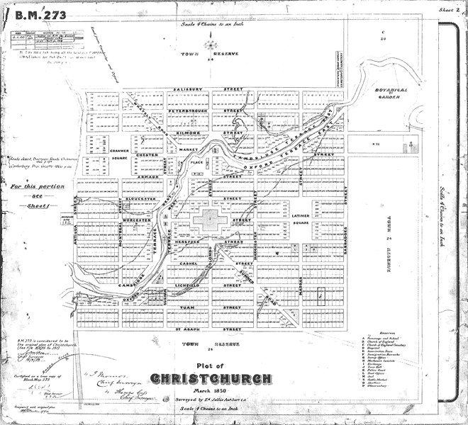
Christchurch’s flat site made it easier to execute its plan. Centred on a central cathedral square, its grid was the most regular of the four settlements, the symmetry broken only by the course of the Avon River and two diagonal streets.
Using this item
Reference: CMU 1559/2
Permission of Canterbury Museum, Rolleston Avenue, Christchurch, New Zealand must be obtained before any re-use of this image.