
State housing
The environmentalist belief that town planning could improve the quality of city life was widely accepted after 1945. This was demonstrated in the construction of new state-housing suburbs in the main cities. The Hutt Valley scheme was the most ambitious and involved the construction of three suburbs – Epuni, Naenae and Taita – along garden-city principles. Streets were curvilinear to follow the topography and reduce monotony, there were ample reserves and houses were mainly single dwellings. The nuclear family was the main social unit and community centres were built to be the hub of social life. These were not as successful as the planners had hoped; people preferred to socialise with neighbours or at home.
Town and Country Planning Act
By the early 1950s only 37 town-planning schemes had been completed under the 1926 Act; Dannevirke Borough Council was the first, in 1936. The slow pace, and growing recognition that rural areas would benefit from planning, led to the Town and Country Planning Act 1953. It required all councils to zone compatible land uses through district schemes so activities could be regulated. Central government would assist in the creation of schemes and oversee them.
Suburban sprawl
A pressing issue confronting planners was suburban sprawl. Councils had encouraged sprawl by rezoning rural land for urban use – providing windfall profits to landowners. But planners argued that the continued loss of productive rural land, and the escalating cost of providing infrastructure to an ever-expanding suburban frontier, made the practice unsustainable.
Cult of the quarter-acre
In 1955 geography professor Kenneth Cumberland condemned suburban sprawl and the ‘cult of the quarter-acre’ for creating slums of different kinds at both the periphery and centre of cities. ‘We take people further from their work and centres of amusement of cultural activities and recreational activities, and wonder at the waste of time and money in travel, at the congestion on roads, and at the mounting cost of public transport,’ he said.1
One solution was to ring-fence cities with a green belt – similar to the New Zealand Company town belts – with development confined to areas within or beyond the belt. The 1949 Auckland Development Plan adopted this measure, although a surging suburban tide soon breached the belt. Christchurch followed a decade later with its own green belt. Another solution was to encourage denser settlement. In 1947 a group of Wellington architectural students suggested razing Te Aro and rebuilding it with high-rise apartments and other functionally arranged buildings. Similarly in 1950 the Auckland City Council proposed replacing the slum-like housing of Freemans Bay with low-rise apartments and town houses. The Wellington plan was deemed too radical, and only a fraction of the Auckland scheme came to pass.
Councils more often used planning tools to effect piecemeal change. Rezoning inner-city residential districts for commercial or industrial use encouraged city residents to relocate to suburbs. The widening of streets became opportunities to demolish decayed buildings and houses.
Satellite cities
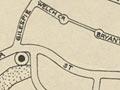
Another response to suburban sprawl was satellite cities. These aimed to decentralise urban growth by building new settlements beyond the parent city, linked to it by road and rail networks. Porirua, north of Wellington, was the only planned satellite city. Designed for a population of 70,000, Porirua was based on garden-city principles and included new suburbs, a town centre, an industrial zone and expanses of parkland. It was meant to contain a balance of state and private housing, but demand for state housing meant resources were directed to meet that need first, delaying private housing. A satellite city for Christchurch at Rolleston fell by the wayside.
Manukau city
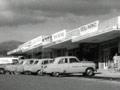
Auckland’s new cities were formed when urban settlements reached city size – at least 20,000 people. While these were not planned as satellite cities, they performed a similar function in decentralising population and business. Manukau city was formed by the 1965 amalgamation of Manukau borough and Manukau county. In 1976 a new Manukau city centre opened near the industrial district at Wiri. Manukau city was initially physically distinct from Auckland, but suburban sprawl soon linked the two cities.
The focus on housing provision also meant the social infrastructure – churches, sporting facilities, public transport, kindergartens and community centres – lagged behind. This led critics to slam government planners for creating dysfunctional communities. Even so, a 1966 social survey found most Porirua East residents were happy with their homes and communities.
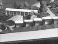
Hydro towns
The hydro construction towns of the mid-1940s to the late 1970s were also based on garden-city planning. They were typically laid out around a central shopping centre, with curvilinear streets, single-unit housing and expansive parklands.