Image
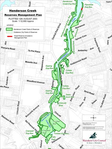
This map shows how adjacent small reserves, including local purpose, recreation and historic reserves, form an almost-continuous belt on both sides of Henderson Creek, in suburban west Auckland. Local authorities are usually responsible for the daily management of such reserves.
Te whakamahi i tēnei tūemi
This item has been provided for private study purposes (such as school projects, family and local history research) and any published reproduction (print or electronic) may infringe copyright law. It is the responsibility of the user of any material to obtain clearance from the copyright holder.