Image
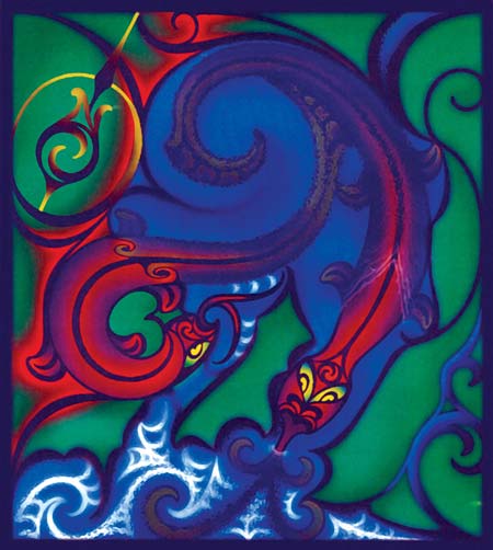
Nā Lee Watt tēnei mahi toi. Ko Ngake rāua ko Whātaitai ēnei, whai muri i te rū nui ki Te Whanganui-a-Tara. He taniwha te tokorua nei. Ko Whātaitai tērā e koromeke ana; ā tōna wā ka huri ia hei kūiti whenua ka hono i a Motukairangi ki te tuawhenua. Ko Ngake kei te huaki putanga mōna ki waho ki Te Moana-o-Raukawa.
Te whakamahi i tēnei tūemi
Chamblett Design Group
by Lee Watt
This item has been provided for private study purposes (such as school projects, family and local history research) and any published reproduction (print or electronic) may infringe copyright law. It is the responsibility of the user of any material to obtain clearance from the copyright holder.