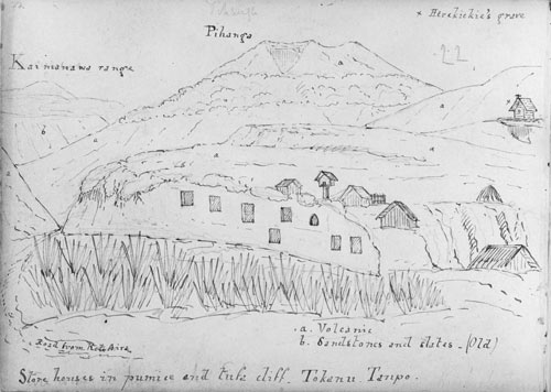
As Wellington’s provincial geologist, James Coutts Crawford made exploratory trips as far north as Lake Taupō in the early 1860s. He made this drawing of Māori pātaka (storehouses) in and on top of a pumice cliff near Tokaanu, at the south end of the lake. Marked with a cross at top right is the grave of Ngāti Tūwharetoa chief Te Herekiekie, who died in June 1861. Crawford also identified the different geological character of Pīhanga (volcanic rocks) and the Kaimanawa Mountains (sandstone and slate). The route to Lake Rotoaira is shown at bottom left – it was reached via the base of Pīhanga, following the approximate route of State Highways 1 and 46 today.
Te whakamahi i tēnei tūemi
Reference: E-041-022
by James Coutts Crawford
Permission of the Alexander Turnbull Library, National Library of New Zealand, Te Puna Mātauranga o Aotearoa, must be obtained before any re-use of this image.