Image
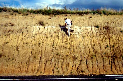
Thick layers of wind-blown dust, known as loess, accumulated over parts of the Manawatū region during glacial periods, when there was little vegetation. This roadside cutting is at Aokautere, near Palmerston North. The thin white layer in the upper part is Ōruanui ash, produced when Taupō erupted about 26,500 years ago.
Using this item
by Alan Palmer
This item has been provided for private study purposes (such as school projects, family and local history research) and any published reproduction (print or electronic) may infringe copyright law. It is the responsibility of the user of any material to obtain clearance from the copyright holder.