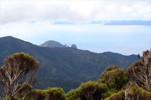
The Moehau Range, with Moehau mountain (892 m) its highest point, forms the northern part of the Coromandel Peninsula. Its predominantly greywacke rock, combined with the high altitude and subalpine vegetation, make it similar to the ranges of the main divide in the lower North Island. This view from the summit of the range takes in Cape Colville, the northernmost point of the peninsula, and looks across to the southern coastline of Great Barrier Island (Aotea Island).
Using this item
Private collection
by Jock Phillips
This item has been provided for private study purposes (such as school projects, family and local history research) and any published reproduction (print or electronic) may infringe copyright law. It is the responsibility of the user of any material to obtain clearance from the copyright holder.