

Hauraki Plains
The Hauraki Plains have been hugely altered from their natural state. What in the 2020s is a grid of farms and straight roads was once a flood plain of bog, swamp, kahikatea forest and overflowing rivers. This transformation is the work of a vast network of canals, drains, stopbanks, floodgates and pumping stations. Canals and the stopbanks along the coast and riverbanks are clearly visible from the road. So too are many other features of drainage: spoil from drain clearing, tree stumps exposed by shrinking peat, elevated roads and drains at close intervals. Hidden from general view are large installations such as pumping stations.
Ngātea
Town on the Hauraki Plains, 23 km south-west of Thames and 25 km north-west of Paeroa, with a 2013 population of 1,245.
Ngātea is a variation on the old Māori name Ngā Ate, meaning the heart or centre. European settlers first used the name ‘The Orchard’ after the Māori-grown peach and quince trees in the area.
From Ngātea to the nation
When Maude Basham’s husband was appointed engineer to the Hauraki Plains county council in Ngātea, she and her family moved there with him from Auckland. Missing the city, Maude (who was always known as Daisy), an experienced singer and performer, started a glee club which performed routines from stage musicals and Gilbert and Sullivan shows. On occasion she would take singing engagements in Auckland, including on radio – the beginnings of her career as the legendary radio personality ‘Aunt Daisy’.
The land ballot at Ngātea in May 1910 was the first on the plains. Ngātea was the most important port on the Piako River, which was bridged at the town. Hauraki Plains County Council (1920–89) and Hauraki District Council (since 1989) have both had their main offices in the town. Hauraki Plains College in Ngātea is the only secondary school on the plains.
Miranda coast
The Miranda coast faces the Coromandel Peninsula across the Firth of Thames. It is part of the Hūnua block, which has been raised in the course of fault movements but not by as much as the peninsula. The same is true of the Hapūakohe Range, further south.
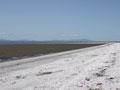
On the Miranda coast tides from the north slowly move gravel, sand and cockle shells southwards down the shoreline. The result is New Zealand’s only chenier plain (a plain made of shell and sand on marine muds). Between Wharekawa and Kaiaua a series of gravel ridges have built up in front of the old cliff line. South of Kaiaua the ridges are composed entirely of sand and shells.
Kaiaua, 42 km from Thames, has an 800-year-old pūriri tree in the local domain. Wharekawa, 5 km to the north, is the site of a Ngāti Pāoa marae. Whakatīwai, between the other two settlements, is known as the burial place of Marutūahu, the ancestor of all the Hauraki tribes.
Miranda
Locality at the south-west corner of the Firth of Thames, known to Māori as Pūkorokoro. In November 1863, the screw corvette HMS Miranda and gunboat Sandfly shelled Pūkorokoro; sailors and marines later landed and occupied the settlement. A redoubt (fort) was built nearby
Miranda is best known as a major reception area for godwits (kūaka), which migrate from Alaska and Siberia for the New Zealand summer; and for its hot springs, with a large hot mineral pool complex.
Waitakaruru
Settlement at the north-west corner of the Hauraki Plains. Its first buildings were erected at the mouth of the Waitakaruru River in 1910, where booms were used in the floating of kahikatea logs. The general store of the time was a goldfield hotel shipped from Kuaotunu.
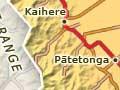
The flax industry of the plains was centred at Kaihere and Pātetonga from 1905 to 1920. The Maukoro Canal directs water from the Hapūakohe Range into the Firth of Thames.
Hard yakka
Returned servicemen and other settlers in the district faced great difficulties. They lacked knowledge of the trace elements essential to farming peat land, prices were depressed and the need to clear drains was constant. Road building involved great toil.
Torehape wetland contains the remnant of a large peat dome (654 ha) a short distance north of the Kopuatai Peat Dome.
Kerepēhi
Kerepēhi, once described as ‘[t]his “island” in the vast swamp’, is known as ‘Kere’ to locals.1 Kerepēhi was chosen as the base for Lands and Survey drainage operations in 1908 because of its location on the Piako River and its elevation above the natural flood level. A large establishment of engineers, shipwrights, blacksmiths, surveyors, clerks and labour gangs was based there until the early 1920s .
A consolidated dairy factory for the plains operated at Kerepēhi from 1954 to 1991; a number of businesses now occupy the former dairy plant. Ngāti Hako have a marae at Kerepēhi and another to the south at Tirohia.
Tūrua
Locality on the Waihou River 14 km south of Thames. The Bagnall family still lives on in the street named after their forebears, who milled the timber of the Tūrua forest in the late 19th century. Remnant kahikatea in the Tūrua domain struggle to survive as a dry, rather than swamp, forest.