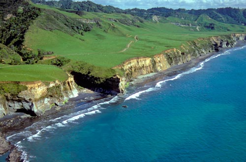
To the north and south of the volcanic ring plain around Mt Taranaki (Taranaki Maunga) are a series of marine terraces or wave-cut platforms, formed by land uplift and sea-level fluctuations over the last 700,000 years. This aerial view of the coast south of Tongapōrutu shows the narrow platform of one of the youngest terraces – about 120,000 years old – and its fossil sea-cliff. Successively older terraces reach up to 20 kilometres inland. The many rivers flowing from the inland hills have cut deeply into the terraces.
Using this item
Natural Sciences Image Library of New Zealand
Reference:
Go1382Rbt.jpg
Photograph by G. R. Roberts
This item has been provided for private study purposes (such as school projects, family and local history research) and any published reproduction (print or electronic) may infringe copyright law. It is the responsibility of the user of any material to obtain clearance from the copyright holder.


Add new comment