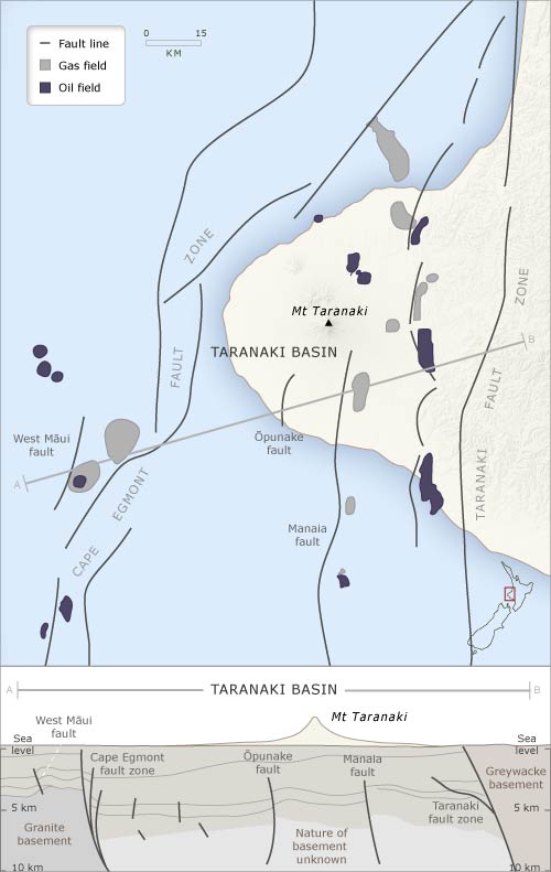
This diagram shows the main features of the Taranaki Basin and its 7-kilometre-deep sediments. Many of Taranaki’s oil and gas reservoirs are found along the fault lines of the region. The Taranaki graben is the large block of crust that has dropped down between the Cape Egmont and Taranaki faults.
Using this item
Te Ara - The Encyclopedia of New Zealand
Source: T. R. Haskell and J. A. Palmer, An outline geology of Taranaki. New Plymouth: Dept. of Lands and Survey, 1984.
This item has been provided for private study purposes (such as school projects, family and local history research) and any published reproduction (print or electronic) may infringe copyright law. It is the responsibility of the user of any material to obtain clearance from the copyright holder.