
Story summary
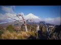
Taranaki is a large area on the west coast of the North Island, centred around the cone-shaped volcano Taranaki Maunga (Mt Taranaki), the upper slopes of which are often covered in snow. Many rivers run down from the mountain, and the deep, fertile soils and moist climate are excellent for horticulture and dairy farming. There are surf beaches along the coast.
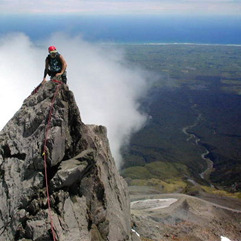
Taranaki Maunga
Taranaki Maunga (Mt Taranaki) is hugely important to local Māori. In tradition, the mountain once lived in the central North Island, and competed with the other mountains to win beautiful Mt Pīhanga. When Taranaki lost, he fled west, gouging out the Whanganui River.
British navigator James Cook was the first Pākehā to see Taranaki Maunga, which he named Mt Egmont. In 1881 an area of forest around the mountain was made a reserve, and in 1900 Mt Taranaki and the Pouākai and Kaitake ranges became Egmont National Park – New Zealand’s second national park. In 2025 Egmont National Park was officially renamed Te Papakura o Taranaki.
Plants and animals
Before humans arrived, Taranaki was covered in thick forest. Māori burnt some of the bush, and after Europeans arrived the forests on the plain around the mountain were mostly cleared for farming.
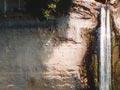
The forests on Mt Taranaki change to shrublands at higher altitudes, then tussock, herb fields and moss fields. The kāmahi forests with their gnarled trees and trailing moss are known as goblin forest.
Rare native animals include the gold-striped gecko, the short-tailed bat, and the meat-eating snail Powelliphanta ‘Egmont’. Archaeological investigations of early Māori sites have found the remains of 55 bird species, including moa and other now-extinct birds.
Māori settlers
The first Māori settlers came to Taranaki about 1250–1300 CE. From the 16th century there were eight tribes – from north to south Ngāti Tama, Ngāti Mutunga, Te Āti Awa, Ngāti Maru, Taranaki, Ngā Ruahine, Ngāti Ruanui and Ngā Rauru. In the early 1800s war parties with muskets arrived from Northland and Waikato, and there were 20 years of devastating raids. Many Taranaki people moved south to avoid the conflict.
Europeans arrive
In 1828 a trading station was set up at Ngāmotu (now New Plymouth). Mission stations were built at New Plymouth and Pātea, and near Hāwera. Planned immigration began in 1841, when the Plymouth Company (a New Zealand Company offshoot) brought settlers from England to the newly surveyed town of New Plymouth.
Taranaki wars
Many Māori opposed selling land to Pākehā, and in 1860 the First Taranaki War began over the sale of land at Waitara. Fighting continued in Taranaki over the next 10 years – longer than in any other part of New Zealand. More than 700 people were killed.
From 1879 a peaceful movement against the government confiscating land grew at the Māori settlement of Parihaka. Many people were arrested and imprisoned, and in 1881 the government invaded the town, arresting its leaders and destroying houses.
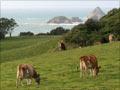
Dairy farming
Since the 1880s dairy farming has been the basis of Taranaki’s economy. At first there were many small factories, but by the 2000s most had closed. In the peak season, Fonterra’s huge factory near Hāwera processes 14 million litres of milk each day.
Oil and gas
A number of major oil and gas fields have been found in Taranaki, and the region is the centre of New Zealand’s oil and gas production.