

After Te Kooti and his followers withdrew to Te Urewera, peace returned and land was made available for settlement. European settlers were drawn to the region, particularly Poverty Bay. There were over 1,200 settlers in Poverty Bay in 1874, and a smaller number at East Cape. A quarter of a century later the region as a whole had a settler population of 10,000. Growth was hindered, but not deterred, by complications arising from land dealings between Māori and Pākehā.
Settlement
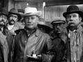
Pākehā who enthusiastically promoted and developed the region included George Read, who had been active in the district since the 1850s, W. L. Rees, who was influential in the 1880s and 1890s, and William Lysnar, active from around 1900 and member of Parliament for Gisborne from 1919 to 1931. They lobbied the government for land for settlement, roads, bridges, ports and railways.
In 1870 most of the region was still forested. Over the next 50 years around 4,000 square kilometres – nearly half the total area – was cleared, with the peak of bush felling taking place between 1890 and 1910.
Agricultural development
Sheep were both shipped and driven into the district. Total sheep numbers rose from 200,000 in 1874, to 500,000 in 1889, 1 million in 1898 and over 2 million in 1910. At the beginning of each summer tens of thousands of sheep were sent away for fattening in regions such as Waikato, Manawatū and Canterbury.
Meat-freezing works were built at Taruheru (1880), Kaiti (1896) and Waipāoa (1916), all in or near Gisborne, and at Tokomaru Bay (1911) and Hicks Bay (1920) along the coast. The Poverty Bay trio competed against each other; the two on the coast were both soon taken over by Gisborne Sheepfarmers Frozen Meat and Mercantile Company, the owners of the Kaiti works.
Between 1895 and the early 1920s cattle numbers increased fivefold, and dairy herds also saw a fivefold increase in the first quarter of the 20th century. The total value of produce exported annually from Poverty Bay rose from £80,000 in 1884 to over £2 million during the First World War, 30 years later.
Dairy factories were established up the coast and at Motu and in the Waimata valley. Dairying grew at the expense of sheep farming. The expansion of freezing works proved to have been optimistic – Taruheru closed in 1923, Hicks Bay in 1926 and Waipāoa in 1931.
Gisborne
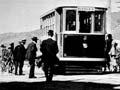
Tūranga, renamed Gisborne in 1870 to avoid confusion with Tauranga, was the hub of the region. It was incorporated as a borough (town) in 1877. The town’s progress was intermittent until the end of the century; the population had only reached 2,737 in 1901. However, in the next quarter-century it grew rapidly due to development in the surrounding region, and by 1926 there were 15,000 people living in the wider urban area.
Growth of the region
The region’s Pākehā population reached 25,000 in 1926 (the Māori population was around 7,000). Rural expansion led to the creation of new counties: Waikohu in 1908, Ūawa in 1918 and Matakaoa in 1919. Harbour boards were set up at Tokomaru Bay in 1915 and Tolaga Bay (Ūawa) in 1919. A separate Gisborne land district was created in 1922 – it had previously been part of Hawke’s Bay. In the same year the region’s sharebrokers joined the Stock Exchange Association of New Zealand.
Some had it good
Rosemary Rees, on a return visit from the UK to her Gisborne family in the summer of 1932–33, was reassured by what she saw, despite it being a time of economic depression. She wrote of being ‘motored here, there, and everywhere to luncheon parties, tennis-parties (where the assemblage of 15 to 20 handsome cars doesn’t exactly give one the impression of utter poverty!), tea-parties and picnics ... the big comfortable houses and gardens are delightful.’1
Wealth and depression
The long boom made the fortunes of many Poverty Bay and East Coast settler families, and many lived in style. Between 1918 and 1921 A. W. Buxton and Edgar Taylor landscaped a private garden at Panikau near Whāngārā, which cost their clients £1,800 (more than $150,000 in 2019 terms). Inland, at Eastwoodhill, William Douglas Cook developed a 150-hectare arboretum of exotic plants from 1910.
There were a number of large homesteads in the region. Puketītī homestead, near Te Puia Springs, was built for A. B. Williams in 1906, with major extensions carried out in 1933. Acton homestead, near Gisborne, was built for a wealthy migrant family from Canterbury in 1907–8. Architect Louis Hay designed a Frank Lloyd Wright-style house at Waiohika, near Waihīrere, Gisborne, in 1926 for Emily Gray, the widow of Charles Gray and a daughter of missionary William Leonard Williams.
The road to Wellington
In January 1934 Gisborne’s unemployed organised a hunger march to Wellington to protest against the pay and conditions under which relief work was provided. They gained sympathy, but not concessions, from the government and its Unemployment Board.
In the early 1930s prices for wool, mutton and dairy products were severely depressed for four seasons in a row. Combined with climatic factors, this caused financial difficulties for many small-scale farmers, often leaving them in debt. In Gisborne, where much work was very dependent on farm spending, unemployment grew rapidly, then fell as commodity prices improved in the later 1930s.