
Volcanic Plateau
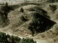
This region, shaped by eruptions 300,000 to 750,000 years ago, is dominated by Lake Taupō, the largest lake in New Zealand. The volcanoes of the Tongariro National Park lie to the south and the Rotorua lakes are in the north.
Minimum winter temperatures are generally 0–3°C, and the annual water deficit is near zero.
Today’s soils were formed from volcanic pumice showers from the Taupō and Kaharoa eruptions, which occurred in the last 4,000 years. Finer pumice also extends as far east as Gisborne, and into the Waikato and Bay of Plenty in the north. Pumice soils are used predominantly for sheep and beef farming, although dairying has expanded in recent years.
Farming this land was impossible until the early 1900s because all ruminant stock suffered from bush sickness, later diagnosed as cobalt deficiency. Before this problem was solved, about 400,000 hectares were planted in exotic forest (Pinus radiata) as the only viable land use. Large areas are now being converted from forestry to pasture for dairying.
Pumice soils usually have a thin, well-developed organic topsoil over a sandy subsoil. Initially, plenty of sulfur-fortified superphosphate is needed to establish pasture. Potassium, magnesium, cobalt and copper, and in some areas selenium, are also usually necessary for stock. Boron deficiency in lucerne and brassica crops is widespread.
Where the soils dry out in summer, the clover content of pasture is usually low and deficient in nitrogen the following winter and spring. Phosphorus, magnesium, boron and possibly nitrogen and potassium are needed for exotic forestry, especially where the soil is coarse and the topsoil shallow.
Taranaki and the King Country
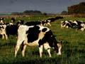
Like the Waikato, Taranaki is widely known as a dairying province. Minimum winter temperatures are mild (3–6°C), especially nearer the coast, and the annual water deficit is near zero.
The rolling landscapes in the western half are dominated by soils made of andesitic ash from Mt Taranaki. In the east, these soils are very crumbly with good drainage, but to the west of the mountain the ring plain has stony soils with impeded drainage. As with other ash-derived soils, these also need phosphorus, sulfur and potassium fertilisers to establish and maintain pasture. Lime is not required because of the naturally suitable soil pH (pH 5.6–6.0).
The land in the east of Taranaki and in the King Country is a mosaic of easier ash-covered slopes and steeply dissected mudstone-, siltstone- and sandstone-derived soils with lower fertiliser requirements. Some phosphorus may be needed for exotic forestry. These soils are mainly used for sheep and beef farming, but erode easily. The pastures will quickly revert to fern and scrub if subdivision and grazing intensity is inadequate.