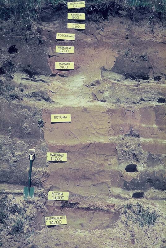
This road cutting at Te Ngae, near Rotorua, shows layers of tephra (pale coloured layers) and buried soils (dark brownish to yellowish-brown horizons). The sequence seen here dates back about 18,000 years. Each tephra fallout was followed by a period of weathering and soil formation. Then the soil would be covered by tephra from a new eruption.
Tephra beds have been given names (for example, Rotomā Tephra) which usually indicate the place where the tephra was first identified, not necessarily the source from which it was erupted.
Te whakamahi i tēnei tūemi
Private collection
Photograph by Simon Nathan
This item has been provided for private study purposes (such as school projects, family and local history research) and any published reproduction (print or electronic) may infringe copyright law. It is the responsibility of the user of any material to obtain clearance from the copyright holder.


Tāpiritia te tākupu hou