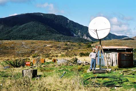
One of the most isolated seismic stations is at Denniston on the West Coast – near Westport on a rocky plateau that is often hidden by cloud. The results are telemetered by satellite to GeoNet headquarters, and can be seen live on the GeoNet website. Regular small blips on the seismic record indicate when coal trucks pass nearby.
Landowner Gary James stands beneath the satellite dish, situated in his backyard.
Te whakamahi i tēnei tūemi
Private collection
by Simon Nathan
This item has been provided for private study purposes (such as school projects, family and local history research) and any published reproduction (print or electronic) may infringe copyright law. It is the responsibility of the user of any material to obtain clearance from the copyright holder.