Image
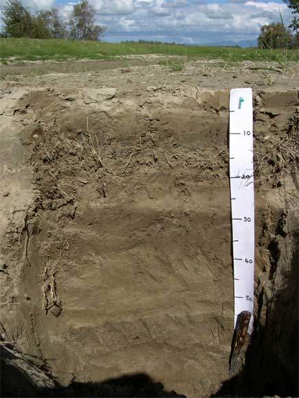
This pit was dug near the Ōroua River, downstream from the Kopane bridge. The scale is in centimetres. The top 15 centimetres is silt deposited by the flood in 2004, overlying dead grass from former pasture. Distinct silt layers can be seen lower down in the pit, indicating that flooding of the river plain occurs repeatedly and is part of the soil-forming process.
Te whakamahi i tēnei tūemi
Private collection
by Carolyn Hedley
This item has been provided for private study purposes (such as school projects, family and local history research) and any published reproduction (print or electronic) may infringe copyright law. It is the responsibility of the user of any material to obtain clearance from the copyright holder.