Kōrero: Historic volcanic activity

Aerial view of Rangitoto (2 o 3)

Aerial view of Rangitoto

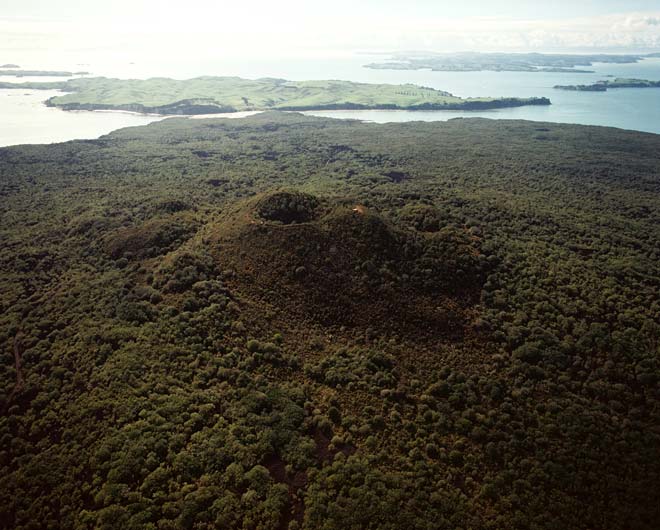
This aerial photograph of Rangitoto’s cone and the surrounding lava field was taken in 1986. Rangitoto is now part of the Hauraki Gulf Maritime Park. Fires and exotic animals have been banned for many years, and the vegetation has returned.

Te whakamahi i tēnei tūemi

GNS Science
Reference: CN8989/22
Photograph by Lloyd Homer

Permission of GNS Science must be obtained before any use of this image.

Ngā whakaahua me ngā rauemi katoa o tēnei kōrero

Te tuhi tohutoro mō tēnei whārangi:

Eileen McSaveney, Carol Stewart and Graham Leonard, 'Historic volcanic activity - Eruptions in early history', Te Ara - the Encyclopedia of New Zealand, http://www.TeAra.govt.nz/mi/photograph/6828/aerial-view-of-rangitoto (accessed 29 March 2024)

He kōrero nā Eileen McSaveney, Carol Stewart and Graham Leonard, i tāngia i te 12 Jun 2006