Image
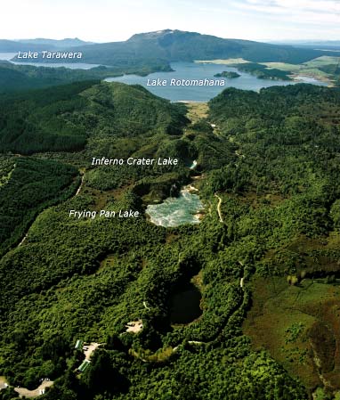
This view shows the Waimangu valley, with Mt Tarawera in the background. When the mountain erupted in 1886, an 18-kilometre line of craters was formed from the summit through the valley. Lake Rotomahana now occupies the central crater.
Te whakamahi i tēnei tūemi
Reference: CN26516/8
by Lloyd Homer
Permission of GNS Science must be obtained before any use of this image.