


Geothermal features are fragile and easily damaged. Hot springs and geysers are sensitive to any changes in their underground water supply, and are easily affected by natural events such as earthquakes and landslides. Over the last 100 years, however, the impact of humans has been vastly greater than that of natural change.
Human impact on the geysers
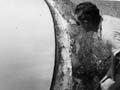
The traditional Māori activities of cooking, bathing, preserving food and heating caused only minimal disturbance. The human impact on geothermal features began early in the 20th century, when wells were sunk in Rotorua to help meet the tourist demand for hot water for bathing and heating. This accelerated after the Second World War. The population increased and there were no effective controls on the drilling and discharge of bores for domestic and commercial heating. By the 1970s the water levels were dropping in Rotorua, and there was an obvious deterioration in the geyser activity at Whakarewarewa.
Geothermal and hydroelectric power stations
New Zealand’s first geothermal power station was built at Wairākei, near Taupō. By the time the first stage was commissioned in 1958, the geysers at Geyser Valley and Taupō Spa had disappeared. When the Ōhaaki–Broadlands field was drilled, the Ōhaaki–Ngāwhā boiling pool declined.
Much of the Ōrākei Kōrako thermal area was flooded in 1961, when the Waikato River was dammed and Lake Ōhakuri was formed to generate hydroelectricity. Two hundred hot springs and 70 geysers were drowned. The area remaining above ground contains only a small proportion of the geothermal features.
Environmental concerns
Although geothermal power was thought to be an environmentally friendly, renewable resource, by the 1970s there was growing public concern about the irreversible damage to surface features, especially geysers. The situation was compounded by legal uncertainty about how geothermal development was regulated and the responsibilities of local and central government.
In a landmark legal case in 1982, the Court of Appeal affirmed that geothermal exploration involved natural water, and that a water right was therefore necessary. Over the next decade this led to a regulatory regime under regional councils, who have responsibility for monitoring and preserving natural geothermal features.
Preserving the geysers
The government started monitoring geothermal activity in the Rotorua area in 1982. Three years later the Ministry of Energy confirmed that there had been a dramatic decrease in geyser activity, related to a 30% decrease in heat flow between 1967 and 1980. Bores within 1.5 kilometres of Pōhutu geyser were closed in 1988.
Since then the water level and pressure in the Rotorua thermal area have generally increased. The geysers and hot springs are no longer dwindling, but the major geysers such as Waikite and Wairoa have not recovered.
Listing the geothermal features
Concerned about the lack of a comprehensive summary of geothermal features, the Geological Society of New Zealand undertook an inventory of all New Zealand’s geothermal fields, and prioritised sites. They paid particular attention to rare or unique features.
Five geothermal fields – White Island (Whakaari), Rotorua, Waimangu, Waiotapu and Ketetahi – were considered to be of international significance, and their complete preservation (including protection from further drilling) was recommended. This has generally been followed in subsequent regional plans.