Kōrero: Earthquakes

Fault rupture, 1987 Edgecumbe earthquake

Fault rupture, 1987 Edgecumbe earthquake

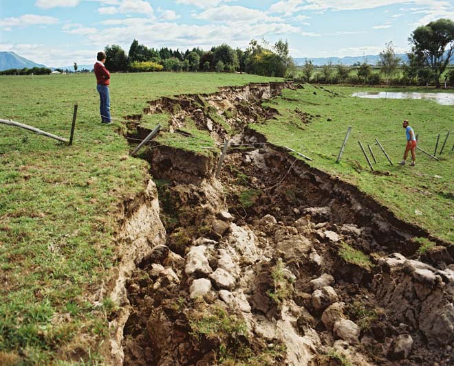
During the 1987 Edgecumbe earthquake, the land to the northwest of the Edgecumbe Fault sank by up to 2 metres. The fault ruptured the surface, forming a seven-kilometre-long rift across the countryside, and causing widespread damage from shaking.

Te whakamahi i tēnei tūemi

GNS Science
Reference: CN10121/18
Photograph by Lloyd Homer

Permission of GNS Science must be obtained before any use of this image.

Ngā whakaahua me ngā rauemi katoa o tēnei kōrero

Te tuhi tohutoro mō tēnei whārangi:

Eileen McSaveney, 'Earthquakes - Seismic activity in New Zealand', Te Ara - the Encyclopedia of New Zealand, http://www.TeAra.govt.nz/mi/photograph/4411/fault-rupture-1987-edgecumbe-earthquake (accessed 25 April 2024)

He kōrero nā Eileen McSaveney, i tāngia i te 12 Jun 2006, reviewed & revised 1 Aug 2017