Image
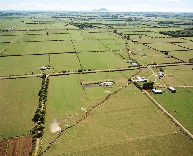
During the Bay of Plenty earthquake of 2 March 1987, a 7-kilometre-long rift appeared across the Rangitāiki Plains – this is the Edgecumbe Fault. The fault had moved previously, rupturing the ground surface, although this was not recognised before the quake. The white patches in the lower part of the photograph are spots where mixtures of water and sand, liquefied by the ground movement, spurted up to the surface under pressure.
Te whakamahi i tēnei tūemi
Reference: CN09977/10
by Lloyd Homer
Permission of GNS Science must be obtained before any use of this image.