
Kōrero: Active faults

Trench across the Ōhariu Fault

Image
Trench across the Ōhariu Fault

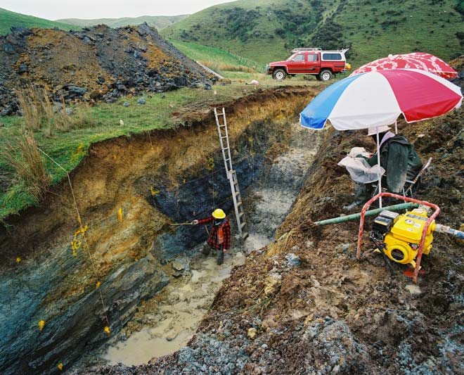
Offset of the ground surface will indicate the location of an active fault, but detailed three-dimensional information can only be obtained by digging a trench. Geologist Russ van Dissen is shown recording the geology across the Ōhariu Fault, in the Wellington region.

Te whakamahi i tēnei tūemi

GNS Science

Reference: CN16937/39

by Lloyd Homer

Permission of GNS Science must be obtained before any use of this image.

Ngā whakaahua me ngā rauemi katoa o tēnei kōrero

Me pēnei te tohu i te whārang

Eileen McSaveney, Active faults – What is an active fault?, Te Ara – the Encyclopedia of New Zealand, https://teara.govt.nz/mi/photograph/4348/trench-across-the-ohariu-fault (accessed 4 June 2026).

He kōrero nā Eileen McSaveney, i tāngia i te 2 March 2009.