Image
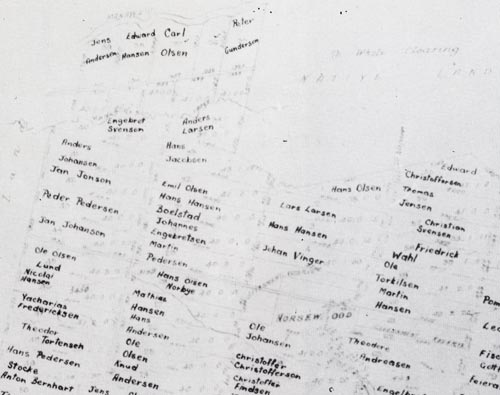
The original map of the town of Norsewood (drawn in the early 1870s) shows the Scandinavian names of immigrant families, and the parcels of land they were allotted. While the settlement looks like a town on paper, the area was covered in bush and the mostly Norwegian settlers had to carve a toehold from the forest.
Te whakamahi i tēnei tūemi
Ray Dean
This item has been provided for private study purposes (such as school projects, family and local history research) and any published reproduction (print or electronic) may infringe copyright law. It is the responsibility of the user of any material to obtain clearance from the copyright holder.
Comments
07 February 2011
27 December 2010