Image
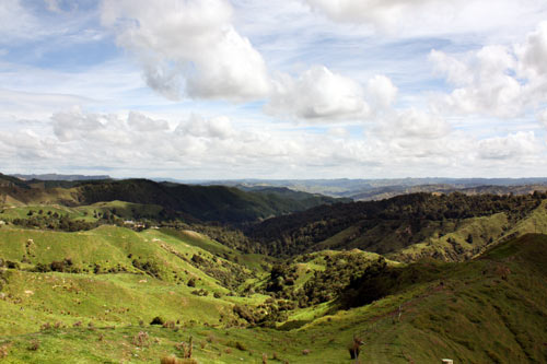
Kaitīeke is a rural farming district north-west of Raurimu. The landscape is a series of hills and valleys. The native bush visible in this photo is a small remnant of the forest that once covered the area.
Te whakamahi i tēnei tūemi
Te Ara - The Encyclopedia of New Zealand
by Kerryn Pollock
This item has been provided for private study purposes (such as school projects, family and local history research) and any published reproduction (print or electronic) may infringe copyright law. It is the responsibility of the user of any material to obtain clearance from the copyright holder.