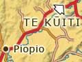

Piopio
Rural service township on State Highway 3, 24 kilometres south-west of Te Kūiti, with a 2013 population of 396. Piopio was laid out around 1902 and served a dairy-farming hinterland.
Piopio School opened in 1909. In the early 1920s the government decided to consolidate small rural schools. Piopio became the first consolidated school in New Zealand in 1924. The first school bus service in the country also started at Piopio that year. A secondary school opened next to the primary school in 1960.
Bird town
All the streets in Piopio’s town centre are named after New Zealand native birds. Piopio itself is the name of an extinct native bird. Streets with bird names include Kaka, Kea, Moa, Ruru, Tui, Huia and Kiwi.
In the early 1990s residents started a beautification committee and turned a vacant section on the main street into a village green. This work continued in the early 2000s. A new committee built a café at the northern entrance to Piopio, which was leased by a private operator, and a monthly market was held on the green.
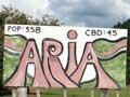
Āria
Farming settlement 14 kilometres south of Piopio. A small township supported by the surrounding farms developed in the early 1900s and Āria School opened in 1908. A dairy factory was established in 1911, and stock saleyards in 1924.
The district’s population dropped after the Second World War, and businesses and services (such as the post office) closed. In the 2000s, the Āria Cosmopolitan Club and the school still operated.
Special gorse patch
In 1962 a new species of giant wētā was found living in a gorse patch on a farm near Māhoenui. The gorse protected the wētā from being eaten by rats, possums and hedgehogs or squashed by grazing stock. The gorse was reserved by the Department of Conservation and fire breaks were established around the site. Māhoenui is the only place these wētā have been found, though some have been relocated to the Ruakurī reserve near Waitomo and another reserve on the Coromandel Peninsula.
Māhoenui
Rural settlement 50 kilometres south-west of Te Kūiti. Māhoenui was one of the earliest areas settled by Europeans after the King Country was opened in the mid-1880s. The first settlers arrived in the late 1890s.
Limestone caves are located in the district. From 1965 members of the Taranaki Caving Club used an old homestead owned by a local farmer (and club member) as a base from which to explore the caves.
Awakino
Coastal settlement 79 kilometres south-west of Te Kūiti and 98 kilometres north-east of New Plymouth. Awakino is on the banks of the Awakino River, which rises in the Hērangi Range. Whitebaiting stations are located along the river.
Traditional Māori pā sites were clustered along the coast around Awakino.
The anchor stone from the ancestral Tainuiwaka is on the grounds of Maniaroa marae near the settlement.
In 1854 the government purchased almost 6,500 hectares of Māori land around Awakino. Because the King Country was closed to Europeans between the 1860s and the 1880s the land was not surveyed until 1883 and was only made available for settlement in 1893.
Farming, flax processing and sawmilling were important early industries in the district. Ships plying the North Island’s west coast called in at Awakino. Coastal shipping declined in the area after the bridge across the Mōkau River opened in 1927 and Awakino was no longer used as a port.
Explosive monument
During the Second World War a live mine floated into the Mōkau River with the tide. The mine was defused and the shell painted and mounted on a concrete base facing State Highway 3, where it remains in the early 2000s.
Mōkau
Coastal settlement 5 kilometres south of Awakino and 83 kilometres south-west of Te Kūiti. Mōkau abuts the northern bank of the Mōkau River and its proximity to Taranaki means it is often considered part of that region. Mōkau is renowned for its whitebait.
Life in Mōkau revolved around the river, both before and after European settlement. It was the traditional boundary between Taranaki and Tainui tribes. People and goods were transported on the river, which flows down to the sea from the Rangitoto Range to the east. The first bridge over the river opened for traffic in 1927.
Māori settlements were located at the river mouth and inland along its banks. Trader Thomas Ralph settled at Mōkau in the 1820s and a Wesleyan mission station was established there in 1843. Up the river, sawmillers felled native bush from the 1840s and coal mines were worked from the 1880s.
The government bought around 840 hectares on the north side of the river in 1854. Europeans left Mōkau after the King Country was closed in the 1860s and the block was not surveyed until 1883. In the 1870s Māori invited some Europeans to settle there, including Joshua Jones, who became infamous for dubious land dealings in the area. The township was laid out in 1896.
By the early 20th century most accessible timber had been felled and dairy farms were established around Mōkau. River-based tourism started in the late 19th century and Mōkau later became popular with holidaymakers.