
Kōrero: East Coast region

Tūranganui-a-Kiwa, Te Kurī-a-Pāoa and the Waipāoa River

Image
Tūranganui-a-Kiwa, Te Kurī-a-Pāoa and the Waipāoa River

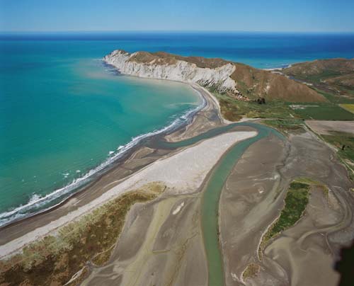
Kiwa and Pāoa captained the Horouta waka (canoe), which made landfall at Tūranganui-a-Kiwa (the great standing place of Kiwa, on the left in this image), later known as Poverty Bay, at the mouth of the Waipāoa (the water of Pāoa, centre) beneath the headland Te Kurī-a-Pāoa (the dog of Pāoa, in the middle distance), also known as Young Nicks Head.

Te whakamahi i tēnei tūemi

GNS Science

Reference: 12936

by Lloyd Homer

Permission of GNS Science must be obtained before any use of this image.

Ngā whakaahua me ngā rauemi katoa o tēnei kōrero

Me pēnei te tohu i te whārang

Monty Soutar, East Coast region – Māori settlement, Te Ara – the Encyclopedia of New Zealand, https://teara.govt.nz/mi/photograph/33353/turanganui-a-kiwa-te-kuri-a-paoa-and-the-waipaoa-river (accessed 4 June 2026).

He kōrero nā Monty Soutar, i tāngia i te 23 August 2011, updated 1 March 2015.