


European settlers were eager to take up land in Poverty Bay and along the coast, and bought and leased land from local Māori until fighting broke out in 1865.
Land loss
After the first wave of fighting the colonial government found ways of punishing the ‘rebels’ in the region and acquiring land for settlement. Māori, whether they had fought against the Crown or not, were expected to make their land available. Around 453,600 hectares (about half of the region) was involved.
An independent commission, later called the Poverty Bay Crown Grants Commission, confiscated three blocks of land in Poverty Bay, totalling just over 22,700 hectares – the major ones at Pātūtahi and Te Muhunga. It also investigated and determined titles to the whole of the 453,600 hectares. There were many inconsistencies and injustices in its decisions, which affected both ‘rebel’ and ‘loyalist’ Māori.
No Ngāti Porou land was confiscated, but the Native Land Court, which had operated throughout the North Island since 1865, held hearings throughout the region with the aim of individualising communal land and certifying titles.
Inspired by the repudiation movement among Māori in Hawke’s Bay, many supporters of Pai Mārire wanted to reject all previous sales and leases of land. They also opposed the confiscations.
The prolonged court proceedings involved in establishing contested land titles put the people and the land of the region, particularly in Poverty Bay, in turmoil for years.
Māori land
Wī Pere, a prominent Poverty Bay leader, proposed that land be leased or sold on a family or hapū basis, rather than by individuals. Pere set up a successful family trust that held on to its lands. He also collaborated with fellow politician William Lee Rees in a company in which Māori put in trust land which could then be developed while they gained a rental income. The venture failed and much of the land held in trust passed out of Māori ownership.
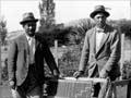
In a capitalist society land was a realisable asset and, apart from their labour, usually the only one Māori possessed. The Tūranga tribes became a rural proletariat, often working as bushmen or shearers – and, with the rapid rise in the Pākehā population, a minority. By 1891 there were more than four Pākehā to every Māori in Poverty Bay.
Ngāti Porou, under the leadership of Rāpata Wahawaha, sold or leased only back-country land. From the 1880s Ngāti Porou engaged in sheep farming on their own account. Relatively few Pākehā families settled in their territory. However, Māori here also resorted to wage work – few could make ends meet without it.
The 1907–8 Stout–Ngata commission of inquiry into Māori land found that around 70% of all land in Cook County (Poverty Bay) had passed out of Māori hands, and of that which remained about half was leased to Pākehā. In Waiapu County (East Cape), around 45% of land had passed out of Māori hands, and about a third of what remained was leased.
Development of Māori land
A number of projects were begun to develop the land Māori still held. Hawke’s Bay landowner J. N. Williams leased 16,000 hectares in the Waipiro Bay district in 1883. He developed the land eventually handed it back to the Māori owners in 1915. Tūpāroa, near Ruatōria, for long the centre of the largest sheep station in New Zealand, reverted to Māori ownership in 1919.
Apirana Ngata, kin to Rāpata Wahawaha, and the first Māori graduate of a New Zealand university, further developed the incorporation system that had been pioneered (although not lastingly) in blocks like Mangatū. This entailed organising multiple small landholdings into a single entity for operational farming purposes. In 1912 Ngata established the Waiapu Farmers Co-operative Company, partly as a way of giving Ngāti Porou access to credit. Ngata also promoted dairying on the Waiapu valley flats in the 1920s. As a government minister he was instrumental in the Native Land and Native Land Claims Adjustment Amendment Act 1929, which made provision for state assistance for the development of Māori land.
Twenty-five development schemes were in operation in the region at the end of the 1930s. Nearly 24,300 hectares had been developed, but the land supported 2,500 people and this did not solve the problem of providing Māori a livelihood from their land.
The quality of Māori housing, health and living conditions remained precarious, as was highlighted by H. B. Turbott in his 1935 report, Tuberculosis in the Maori, East Coast, New Zealand.