Image
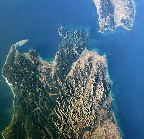
The Alpine or Wairau Fault, which cuts Marlborough in two, shows up clearly in this satellite shot of the upper South and lower North islands. The fault is visible partly because the Richmond Range, to its north, is forest-covered, while the ranges to the south are in tussock or pasture.
Te whakamahi i tēnei tūemi
This item has been provided for private study purposes (such as school projects, family and local history research) and any published reproduction (print or electronic) may infringe copyright law. It is the responsibility of the user of any material to obtain clearance from the copyright holder.