Image
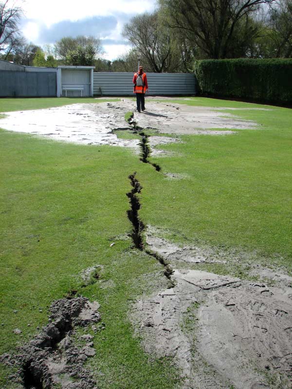
Liquefaction occurs during earthquakes when the underlying geology of water-saturated loose sand and silt is shaken and turns to a mush. Areas especially prone to liquefaction include former river channels, wetlands, and ponds. In places where the surface has ruptured, sand and silt can be forced out of the ground. This occurred at the Kaiapoi Croquet Club where surveyor Angelique Zajac is seen measuring the trace of large cracks on Friday 10 September, almost a week after the quake.
Te whakamahi i tēnei tūemi
by Nicola Litchfield
Permission of GNS Science must be obtained before any use of this image.