Image
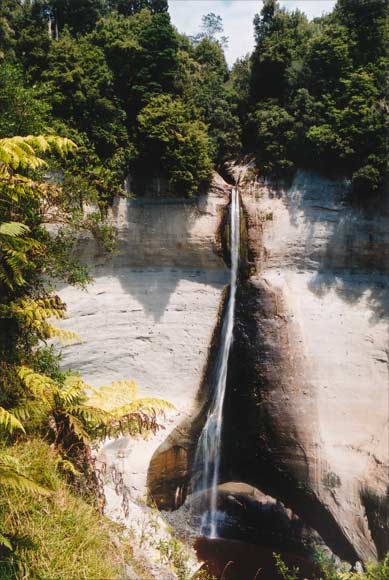
A swampy tableland at an elevation of 300 metres drains to the headwaters of the Tongapōrutu River over the impressive Mt Damper Falls. With a single drop of 85 metres, the falls are among the North Island’s highest. They are easily reached by a short walk from the Mangapapa Road car park.
Te whakamahi i tēnei tūemi
Private collection
by Ron Lambert
This item has been provided for private study purposes (such as school projects, family and local history research) and any published reproduction (print or electronic) may infringe copyright law. It is the responsibility of the user of any material to obtain clearance from the copyright holder.