Image
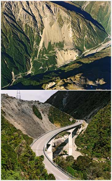
Rockfalls and screes have been a hazard for road construction and maintenance through the Ōtira gorge, west of Arthur’s Pass. For more than 100 years a winding section of the road (known as ‘the zig-zag’) skirted around the top of a landslide (above). In 2001 this was replaced by a viaduct (below), close to the Ōtira River beneath the zig-zag.
Te whakamahi i tēnei tūemi
Reference: CN35817/25 and CN43352/23
by Lloyd Homer
Permission of GNS Science must be obtained before any use of this image.