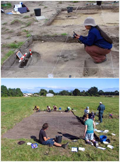
Excavations at the Kawatiri archaeological site, near the mouth of the Buller River, indicates that people were living close to Westport by the early 14th century. The photographs show a general view of the site when a University of Otago team started excavation (lower), and a more detailed view of part of the site when it was opened up (above).
Excavations at this site have revealed a number of adzes and flaked tools from a variety of sources, including obsidian from Mayor Island in the Bay of Plenty, baked argillite (adzite) from Nelson, and pounamu (greenstone) from the Arahura valley. It is clear that there was considerable exchange among Māori of different stones suitable for making tools.
Te whakamahi i tēnei tūemi
by Richard Walter
Images reproduced courtesy of Te Runanga o Ngati WaewaeThis item has been provided for private study purposes (such as school projects, family and local history research) and any published reproduction (print or electronic) may infringe copyright law. It is the responsibility of the user of any material to obtain clearance from the copyright holder.