Image
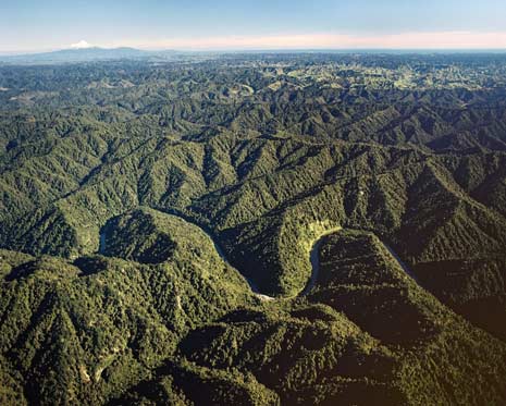
This aerial shot of the Whanganui hill country – looking west from the Whanganui River towards Mt Taranaki – shows the contrast between an incised river valley and the ridges that flank it. The region’s rivers have cut down into the sedimentary rock as the land has risen; the former plain survives in the ‘summit accordance’ – ridge after ridge of approximately the same height.
Te whakamahi i tēnei tūemi
Reference: 8702/37
by Lloyd Homer
Permission of GNS Science must be obtained before any use of this image.