
Kōrero: Soils and regional land use

Irrigation circles

Image
Irrigation circles

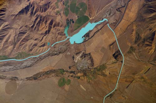
This satellite view shows green circles of irrigated pasture near Twizel, in the Mackenzie Country.

Te whakamahi i tēnei tūemi

NASA-Johnson Space Center

Reference: ISS014-E-18945

This item has been provided for private study purposes (such as school projects, family and local history research) and any published reproduction (print or electronic) may infringe copyright law. It is the responsibility of the user of any material to obtain clearance from the copyright holder.

Ngā whakaahua me ngā rauemi katoa o tēnei kōrero

Me pēnei te tohu i te whārang

Allan Gillingham, Soils and regional land use – Eastern and southern South Island, Te Ara – the Encyclopedia of New Zealand, https://teara.govt.nz/mi/photograph/17110/irrigation-circles (accessed 4 June 2026).

He kōrero nā Allan Gillingham, i tāngia i te 1 March 2009.