Image
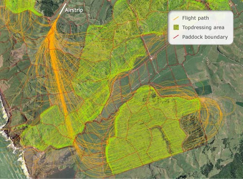
The development of GPS technology for topdressing aircraft has greatly improved the uniformity of fertiliser spread on hill country pastures. The system guides the aircraft along a prescribed path, tracing it onto a map that shows where the aircraft has been. This includes recording the paths back to the fertiliser bin (top left ). The green area is the land to be topdressed.
Te whakamahi i tēnei tūemi
This item has been provided for private study purposes (such as school projects, family and local history research) and any published reproduction (print or electronic) may infringe copyright law. It is the responsibility of the user of any material to obtain clearance from the copyright holder.