Image
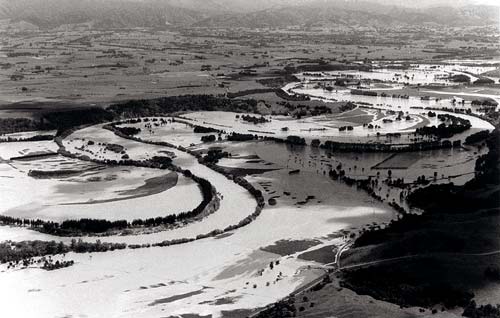
The Wairarapa basins were built up from gravels carried by rivers in flood. Flooding remains a periodic problem, and an extensive system of flood control works has been put in place. These are sometimes breached, causing extensive flooding. This is the Ruamāhanga River in flood near Morrison’s Bush, east of Greytown.
Te whakamahi i tēnei tūemi
Greater Wellington Regional Council
This item has been provided for private study purposes (such as school projects, family and local history research) and any published reproduction (print or electronic) may infringe copyright law. It is the responsibility of the user of any material to obtain clearance from the copyright holder.