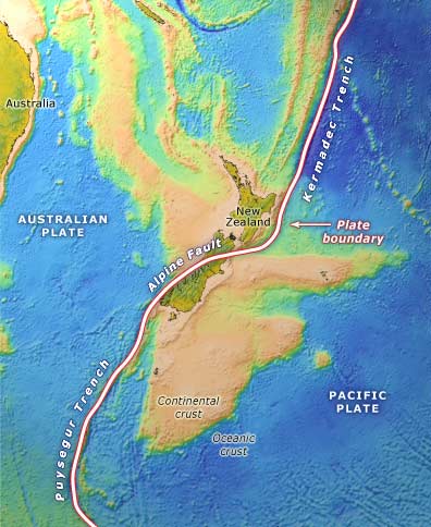
The boundary between the Pacific and Australian plates passes through New Zealand. The Pacific Plate is moving towards the Australian Plate at a rate of about 40 millimetres a year. The deformed zone, close to the plate boundary, is where most earthquakes and uplift take place.
Te whakamahi i tēnei tūemi
Te Ara - The Encyclopedia of New Zealand
Source: Ray Wood and others, New Zealand’s continental shelf and UNCLOS Article 76. Lower Hutt: Institute of Geological and Nuclear Sciences; Wellington: National Institute of Water and Atmospheric Research, 2003
This item has been provided for private study purposes (such as school projects, family and local history research) and any published reproduction (print or electronic) may infringe copyright law. It is the responsibility of the user of any material to obtain clearance from the copyright holder.