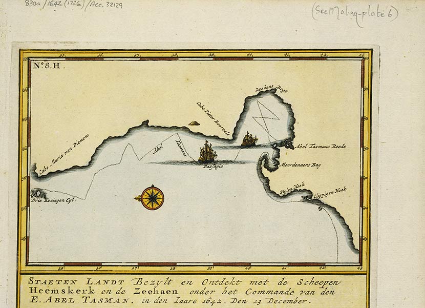
Abel Tasman was the first European to map New Zealand’s coast in 1642–43. He named the place he discovered Staten Landt, thinking it was part of South America. His chart is oriented with north to the left and south to the right. The most readily recognisable feature is the curve of Farewell Spit (middle right). There are no depth soundings on the chart, but it is clear that Tasman knew that the area around Farewell Spit was shallow, as he has marked sandbars there.
Te whakamahi i tēnei tūemi
Alexander Turnbull Library
Reference:
MapColl-830a/1642(1726)/Acc.32129
Permission of the Alexander Turnbull Library, National Library of New Zealand, Te Puna Mātauranga o Aotearoa, must be obtained before any re-use of this image.


Tāpiritia te tākupu hou