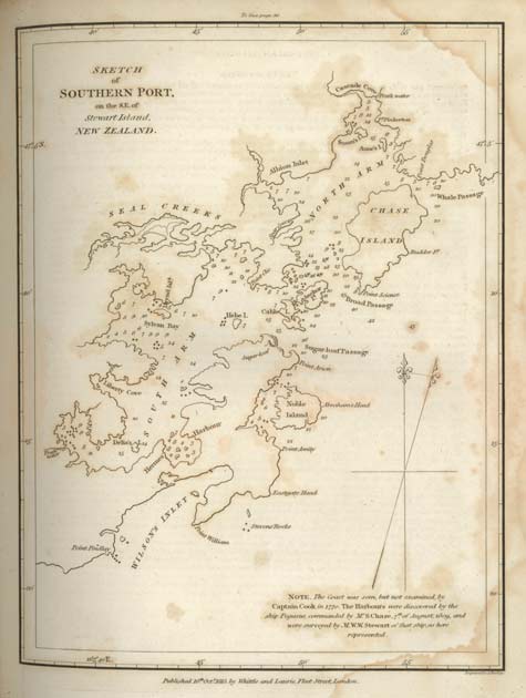
This chart of Southern Port (now Port Pegasus), at the southern end of Stewart Island, was drawn by cartographer William Stewart, first mate aboard the sealer Pegasus. He was employed by Captain Samuel Chase, as seals were becoming scarce and he wanted to search ‘every crack and corner’ of the southern South Island. The ship was leaking badly after a trip to the Chatham Islands, and spent two months at Southern Port being repaired. This gave Stewart time to chart the harbour, using nothing but ship’s instruments and a lead line for soundings. His chart compares favourably with modern charts of the area, and it is fitting that Stewart Island is named after him.
Te whakamahi i tēnei tūemi
Hocken Collections, University of Otago
Permission of the Hocken Collections Uare Taoka o Hakena, University of Otago, must be obtained before any re-use of this image. Further information may be obtained from the Library through its website.