Image
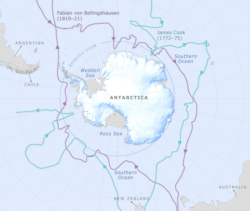
The routes taken by British navigator James Cook in 1772–73 and Russian admiral Fabian von Bellingshausen in 1819 are shown on this map. Both travelled within the Antarctic Circle, but their explorations were complementary, with Bellingshausen filling in many of the gaps left after Cook’s expeditions.
Base map provided by the Australian Antarctic Data Centre.
Te whakamahi i tēnei tūemi
Te Ara - The Encyclopedia of New Zealand
This item has been provided for private study purposes (such as school projects, family and local history research) and any published reproduction (print or electronic) may infringe copyright law. It is the responsibility of the user of any material to obtain clearance from the copyright holder.