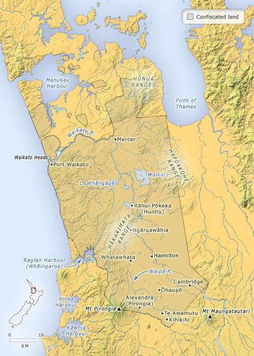
After the Waikato war, Māori-owned land in west Waikato was confiscated. Most of the Māori population withdrew behind the ‘aukati’ or boundary line of the Pūniu River, in what became known as the King Country (because the Māori King had taken refuge there). This map shows the boundaries of the land confiscated by proclamation of Governor George Grey in December 1864. That year soldier settlers moved into abandoned Māori villages, former military posts and new militia towns which were established to guard the frontier.
Te whakamahi i tēnei tūemi
Te Ara - The Encyclopedia of New Zealand
This item has been provided for private study purposes (such as school projects, family and local history research) and any published reproduction (print or electronic) may infringe copyright law. It is the responsibility of the user of any material to obtain clearance from the copyright holder.