Image
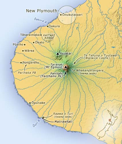
This map shows the major landmarks in the traditional area of the Taranaki tribe. Ōnukutaipari marks the northern boundary, while the Ōuri River forms the southern boundary. The territory includes Mt Taranaki (Egmont).
Te whakamahi i tēnei tūemi
Te Ara - The Encyclopedia of New Zealand
This item has been provided for private study purposes (such as school projects, family and local history research) and any published reproduction (print or electronic) may infringe copyright law. It is the responsibility of the user of any material to obtain clearance from the copyright holder.