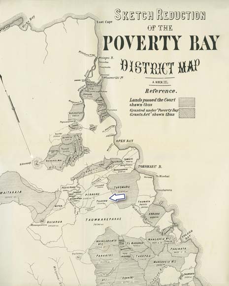
Published in 1877, this map shows the blocks of land in Poverty Bay which had passed through the Native Land Court, as well as land granted under the Poverty Bay Grants Act of 1869. Some of the areas not shaded (such as Tuakau, marked) were still in the process of being surveyed for the Native Land Court. A conflict in 1875 led to a surveyor’s theodolite and chain being taken by Māori, because one of the surveyor’s men had begun surveying within the boundaries of the Tuakau block.
Te whakamahi i tēnei tūemi
Te Ara - The Encyclopedia of New Zealand
Reference: Appendices to the Journals of the House of Representatives, 1877, G-5
This item has been provided for private study purposes (such as school projects, family and local history research) and any published reproduction (print or electronic) may infringe copyright law. It is the responsibility of the user of any material to obtain clearance from the copyright holder.