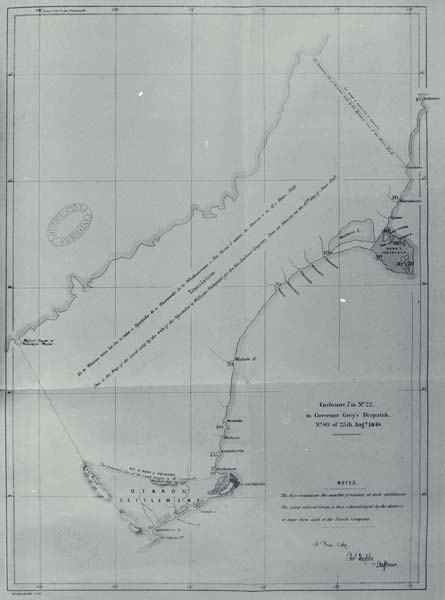
This map, a copy of the original by Charles Heaphy, shows the extent of H. T. Kemp’s purchase on behalf of the Crown of 20 million acres of the South Island, negotiated between the Crown and the Ngāi Tahu tribe in 1848. It also shows the Ōtākou purchase (four years earlier) and the sale of Banks Peninsula to the French. The boundaries, particularly the northern and western ones, have been the subject of much subsequent debate. Although Kemp was meant to survey off the boundaries and reserves at the time of the sale, he did not, and Walter Mantell was charged with doing this the following year.
Te whakamahi i tēnei tūemi
This item has been provided for private study purposes (such as school projects, family and local history research) and any published reproduction (print or electronic) may infringe copyright law. It is the responsibility of the user of any material to obtain clearance from the copyright holder.