Image
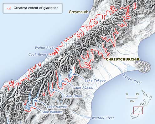
This map shows the maximum extent of ice during the last (Ōtira) glaciation, between 75,000 and 14,000 years ago.
Te whakamahi i tēnei tūemi
Te Ara - The Encyclopedia of New Zealand
Source: Colin J. Burrows, Julius Haast in the Southern Alps. Christchurch: Canterbury University Press, 2005, p. 71
This item has been provided for private study purposes (such as school projects, family and local history research) and any published reproduction (print or electronic) may infringe copyright law. It is the responsibility of the user of any material to obtain clearance from the copyright holder.